


How to travel to APEX sequitor
1. From Calama to San Pedro
|
CALAMA:
EL LOA AIRPORT ROUTE MAP
|
|||
 |
|||
|
1
|
Road to Antofagasta
|
213 km | |
|
2
|
Road to Calama
|
4 km | |
|
3
|
Road to San Pedro de Atacama
|
97 km | |
| The blue
line on the map above shows the way from the airport to the road
to San Pedro. The green line marks the road to San Pedro. There
are small green road signs that show the distance from Calama every
5 km.
The road is more or less straight until km 55. The landscape is flat and featureless, and it is difficult to notice the distances and speed of the car. The speed limit in Chile is 100 km/h. The road crosses "Paso Barros Arana" at 3400 m altitude at km 55. After the pass there are many dangerous curves. Drive carefully and not too fast. At approximately km 80 the road crosses "Llano de la Paciencia" (The Field of Patience), and runs straight for about 10 km. |
|||
2. San Pedro and the bypass road
|
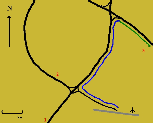
SAN PEDRO
DE ATACAMA: ROUTE MAP TO SEQUITOR
|
|||
 |
|||
|
1
|
Coming from the Airport | ||
|
2
|
Road to APEX - Sequitor | ||
|
3
|
Road to Chajnantor | ||
|
4
|
Road to ALMA Camp | ||
|
5
|
Road to Moon Valley | ||
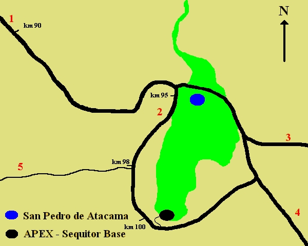
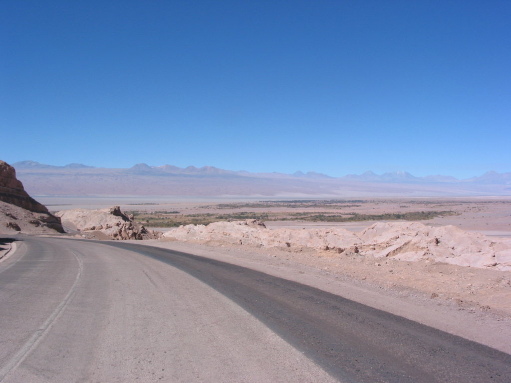
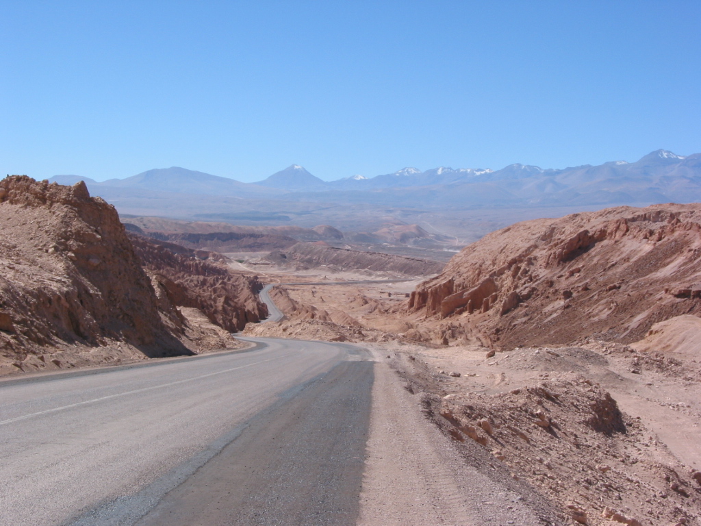
| At about km 90 the San Pedro de Atacama Valley can be seen (Picture A) and later on Cordillera de la Sal (Picture B). | |||
 |
 |
||
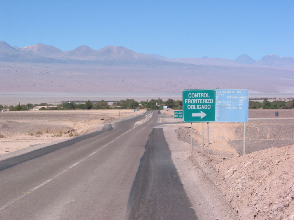
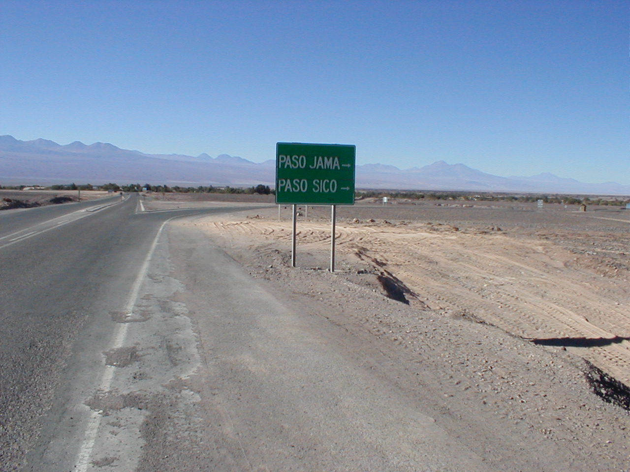
| At about km 94 just before the entrance to San Pedro, take a RIGHT TURN onto the bypass road around San Pedro. There are road signs saying "Control Fronterizo Obligado" and then "Paso Jama and Paso Sico" (Pictures C and D). | |||
 |
 |
||
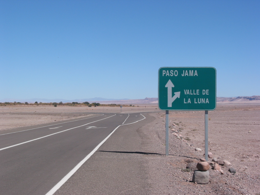
| Continue on the bypass road. At km 98, there is an exit to the Moon Valley, but continue straight on in the direction of PASO JAMA (Picture E). | |||
 |
|||
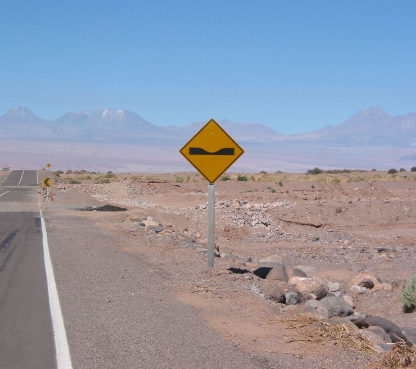
| The exit to the APEX base is close to km 100. Drive carefully, because there are two river crossings along the road (most of the time without water, Picture F). | |||
 |
|||
3. Sequitor and the APEX base
|
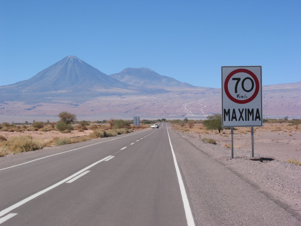
The exit to the APEX base is shortly after the first 70 km/h sign. Take to the LEFT. Picture G shows a white pickup truck at the exit, and Picture H is a close-up of the exit. The road is a dirt road, which is in bad shape the first 25m. |
|||
 |
 |
||
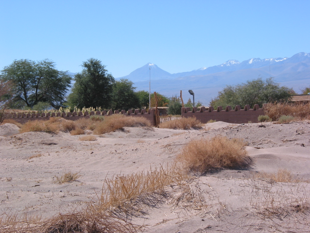
| The APEX base is now on the right side, with the entrance after about 200m on the dirt road. Picture I shows the adobe wall surrounding the base, and some of the buildings are also seen. | |||
 |
|||
|
WELCOME
TO APEX !!
|
|||